


Topographic World Map 3D Printer Model
The file 'Topographic World Map 3D Printer Model' is (zip,stl) file type, size is 306.9MB.
The file 'Topographic World Map 3D Printer Model' is (zip,stl) file type, size is 306.9MB.
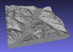
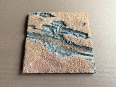
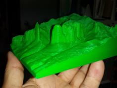
Explore the world in 3D with this topographic world map puzzle!
This unique design includes all elevations, allowing you to feel the contours of each continent.
By printing it with 100 % the world map has a size of 1800 x 750 mm.
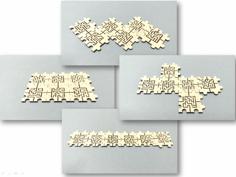
The files are conveniently sorted by continents, each with its initial number for easy assembly.
Dive into geography and bring the world to your fingertips!
For comercial usage, just send me a message. Than we will find an agreement
If you want to support me. Please leave some love here and "Buy me a Beer". Thank you.
![]()
| 1_Europe.zip | 74.5MB | |
| 1_Germany.stl | 1.7MB | |
| 2_Asia.zip | 44.5MB | |
| 3_Oceania.zip | 11.0MB | |
| 4_Africa.zip | 39.1MB | |
| 5_South_America.zip | 24.6MB | |
| 6_North_America.zip | 128.4MB |